Geography


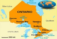
Toronto covers an area of 630 square kilometers (243 sq mi), with a maximum north-south distance of 21 kilometers (13 mi). It has a maximum east-west distance of 43 km (27 mi) and it has a 46-kilometer (29 mi) long waterfront shoreline, on the northwestern shore of Lake Ontario. The Toronto Islands and Port Lands extend out into the lake, allowing for a somewhat sheltered Toronto Harbour south of the downtown core. An Outer Harbour was constructed southeast of downtown during the 1950s and 1960s and it's now used for recreation. The city's borders are formed by Lake Ontario to the south, the western boundary of Marie Curtis Park, Etobicoke Creek, Eglinton Avenue and Highway 427 to the west, Steeles Avenue to the north, and the Rouge River and Scarborough–Pickering Townline to the east.